
Cable module
Our software is designed for many different fields. We continuously develop innovative solutions for infrastructure management, water management and the energy supply sector.
For the cable module, our developers create optimum systems for data collection or planning, calculation or classification, administration and updating, including valuation and operational management of cable networks.
Watch BaSYS CableDATA Video (Video in German language)
CableDATA manages network objects such as cables, routes, track sections and cable nodes in clear forms. The elements of a route are divided into hierarchical levels, which allow an image of the cable line objects in different detail stages. The structure is divided into sections, cross sections, cable runs and the individual cables. The cable nodes are divided into network nodes, house connections and other nodes, which allow the administration of user-defined objects.
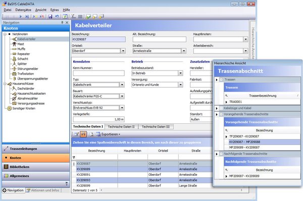
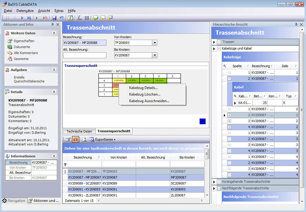
All forms are structured according to the technical requirements. In the hierarchical view, you can switch directly to the parent or subordinate element. Via the right mouse button the direct change to the start or end node of a line object is possible. The diagram of the train cross sections is supported by a schematic representation, which visualizes the position, occupation and utilization of the cable pulls. The cross-section configuration can be processed directly via this graphic.
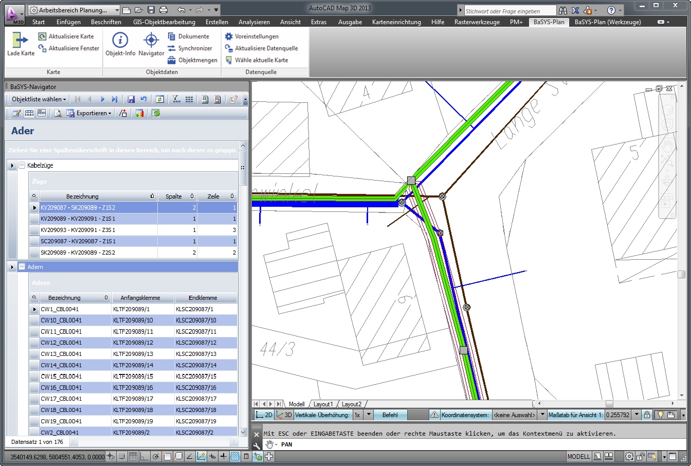
By integrating the database-assisted BaSYS planning functions in the leading CAD and GIS systems (eg AutoCAD, ArcGIS, Geomedia and Microstation), BARTHAUER offers the user specific design and acquisition tools. Constructed or recorded components of the fiber optic networks, including all technical information, are automatically stored in a central database. This makes the automatic visualisation of generated network data in the respective graphics applications possible without postprocessing. Also, all the information of the design, e.g. Text positions or separate colouring, are managed by the database management system. The filtering and processing of the material data can be carried out directly in the graphic.
In addition to a representation in the position and the longitudinal section, BaSYS Cable also supplies the planning in cross-section. The utilisation and freespace for the assignment of further cables and cores can be taken directly from the schematic cross sectional view. This gives the planner further support in order to optimise the cable routing and avoid further processing steps.
Since, in a comprehensive infrastructure planning, the connection to other specialist areas is also provided, the routing can also be carried out, for example, via the management of the wastewater holdings. The assignment of the disposal pipes makes the time-consuming digitization of the track sections unnecessary.
The design of the plan can be based on standard or task-related requirements. By using the models, the automatic design, including all text information, is possible in various detail levels (eg overview plan, detail plan or theme plan).
By supporting Spatial Data Standards, SDO (Oracle), and Spatial Data (MS SQL Server), BaSYS provides much more flexible access to BaSYS data for external CAD and GIS applications.